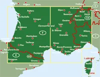
Explore the south of France with this Freytag & Berndt double-sided road map. The best way to plan your trip, prepare your itinerary, and to travel independently in the following regions: Franche-Comte, Bourgogne, Centre, Poitou-Charentes, Aquitaine, Midi-Pyrenees, Languedoc-Roussillon, Provence-Alpes-Cote-d'Azur, Rhone-Alps and Corsica, as well as the Principauty of Andorra, the Spanish Pyrenes, Liguria, Piedmont, Aosta Valley, and the southwest of Switzerland.
As with all Freytag & Berndt maps the cartography is clear and detailed with the topography shown by relief shading with plenty of spot heights.
Tourist information and places of interest are clearly marked by a range of icons, including:
- picturesque towns, places of particular interest
- churches, monasteries, castles and ruins
- archaeological sites and caves
- mountain cabins, camping sites and youth hostels
- golf courses
- airports, marinas and museums
Distances between points are shown as well as indications of steep gradients, all distances are in kilometres. The legend is in several languages inlcuding English.


